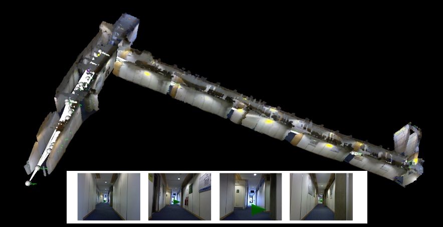
 The ability to create accurate 3D models from consumer equipment is fast becoming a reality. While still not fully mature, approaches are currently available enabling individuals to capture relatively accurate representations of interior buildings. This project aims to investigate the consumption and use of such data. Taking a crowd sourced perspective the project investigates the feasibility of a system where users are encouraged to contribute partial models they want to, are able to, or, incidentally capture. Focusing on the application of indoor navigation as a specific use case the project has a number of aims:
- The development of indoor models and infrastructure to enable crowd contributed models to be situated in external mapping environments such as Open Street Map. For this aspect existing technology and consumer devices will primarily be used, with investigations into capture techniques such that additional human interaction can be incorporated to simplify the task while still providing an attractive and unobtrusive capture process. The investigation aims to span a range of input devices including RGB-D cameras which have recently entered the consumer market in the form of the Xbox Kinect as well as more traditional photo/video devices.
- An investigation into the use of partial 3D models and algorithms for route planning and automated selection of unique/salient objects unique throughout the route enabling landmark based navigation.
- Investigate privacy and permission implications of such systems, considering the crowd sourced nature of such data and the potential for the capture of private material incidentally. This part of the project is linked to the Dataware project.
- Explore what makes a crowd sourcing effort for geospatial ‘go viral’ and accumulate sufficient following to provide useful data.
- Explore how this project can be informed by and inform the indoor navigation project supervised by Chris Hide.


