06
11
.15
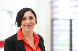
Focus on Research – Dr Laura Carletti
Museums are increasingly investing into providing online access to their collections. Particularly, new media and technologies are reshaping cultural institutions’ relationship with the public by providing alternative forms of participation. For this reason, Horizon Digital Economy Research at the University of Nottingham, Tate, and the
University of Exeter began collaborating on the ArtMaps project, which experiments with a new way of exploring art: via location. Enter Horizon Research Fellow Dr Laura Carletti, whose work focuses on ways to use technology to increase engagement.
“When I finished my PhD, the ArtMaps project was just starting. As the project’s objective was to explore the relation between art and place, and to develop a crowdsourcing tool to offer an alternative way to engage the public with the Tate collection,” she says. “It was really linked to my research focus, which is to investigate engagement strategies through new media and technologies, especially in the arts and humanities sector.” ArtMaps has been her main project for the last three years. Along with the rest of the ArtMaps research team, Laura won the EPSRC’s “Telling Tales of Engagement” prize at the Digital Futures Conference 2012.
Essentially, ArtMaps is a project with several goals. One of them is to ‘map’ the Tate collection, which includes nearly 70,000 artworks. More research-oriented, however, is the effort to test the platform used to support this endeavour and to use the project to gain insight into how people relate artwork and location, as well as the user experience, the use of mobile technologies, and the value of the crowd-sourced input.
The idea to put the Tate collection on a map had been thought for some time. Then, during the process of digitising the collection, it emerged that more than 23,000 of the nearly 70,000 items had location identifiers included among their metadata. It also turned out that, although for some artworks the location information was quite specific (e.g. exact latitude and longitude of the landmark or sight depicted in the work), for many of them, the location information was quite general, referring only to a city, region, or major geographic feature.
The ArtMaps concept originated from these findings, along with Tate’s interest in involving the public in contributing location information associated with the artworks through a crowdsourcing platform. The need is genuine: ArtMaps is built on Google Maps, and identifying “Canterbury” as the location of a painting of a cathedral will place the pin in the map in the centre of Canterbury – which seems to be a few blocks from the cathedral itself.
Laura notes that this was one of the challenges of designing the ArtMaps application: “When you translate location into Google Maps, given the affordances of the technology you have to tie the artwork into one single location, whereas artworks can have ties with multiple locations.”
Laura’s background is in arts and humanities; she has a PhD in technology-enhanced learning from the University of Marche, Department of Information Engineering. Her PhD research focused on online grassroots communities, starting with the Ghostsigns project. This initiative – aiming to photograph and preserve faded painted wall advertising signs – was promoted by an amateur collector, who asked for help in building an online archive of ghostsigns through the use of a variety of social media sites. The archive was a pioneer crowdsourcing initiative. For Laura, it provided an opportunity to study online engagement and the way social media are used by Web-based communities to cultivate diverse and often niche interests.
“That was how I initially got interested in crowdsourcing as a mechanism to engage people in the co-creation of cultural resources,” she says.
One of the interesting aspects emerged from the ArtMaps project lies with the fact that locating artworks isn’t as straightforward as it sounds. For one thing, many paintings can be associated with several locations. Think, for example, of Marc Chagall’s Bouquet with Flying Lovers, which Chagall began while living in Paris in the mid-1930s. He finally finished it 13 years later, shortly after his wife’s death; besides evocations of his memories of their marriage it includes an image of the Russian town he was born in. More fine-grained is David Hockney’s Meeting the Good People (Washington), which shows “a rake’s progress” visiting several famous Washington, DC landmarks.
Other works combine real locations in fantastical ways, as in William Marlow’s Capriccio: St Paul’s and a Venetian Canal, in which London’s St Paul’s Cathedral appears to be reachable by gondola. For still others, the significant location is the one the artist occupied while painting it, which dictated the exact view of a particular landscape. Other variations on the relationship with location include fantasy landscapes or, in a case Laura cites, incidents that never happened even though the locations that inspired them are real. In this case, the artist – Carel Weight – painted a fictitious attack on a woman by a lion at the London Zoo, which he visited as a child with his mother, who also posed for the painting. The location is not made plain in the painting or its title; the association is only to be found in the written memories of the artist.
Another experience, working with the Museo Omero to create an art-trail for people to follow around Ancona (Italy), Laura’s Italian home town, confirmed how the relationship between artworks and location is open to interpretation.
One advantage of this approach – and also of the NFC experiment implemented as part of the Women in Latin America project (see below) as compared to the more traditional audio guides – is to allow visitors greater independence in interacting with museums’ objects, as well as in outdoor experiences. Laura stresses the ‘magic’ and the power of technologies in supporting enhanced experiences, beyond the simple provision of information. The Museo Omero event, for example, enabled visitors to experience a historical look at the town through the eyes of English visitors to Ancona during the 18th and 19th centuries as part of their “Grand Tour”.
“It’s a view from the past you can only have through narrative, books, and paintings,” Laura says. “It’s kind of seeing these places through the eyes of the artists and writers who visited them” This is another element that’s unevenly distributed: modern Oxford is very similar to the Oxford painted by JMW Turner – “like a photography from the past” – but many other places are not.
Overall the point is, as Laura says, “to study how to take the museum out of its walls and make people experience it and create new associations.”
Women in Latin America: Horizon also investigated other uses for the ArtMaps platform. The most significant is the Women in Latin America project, which seeks to show the history of independence in Latin America from women’s point of view. Based on the earlier Genderlatam work by Dr Catherine Davies, the project imports datasets Catherine created to study ways to involve people. Among the project’s engagement events, Uncovering the Invisible – an interactive and touring exhibition – was organised, displaying a series of portraits of Latin Americans living in the UK by the photographers Roxana and Pablo Allison. At live versions of the exhibition, Laura experimented with the use of NFC (for Near Field Communication) tags under each portrait. When tapped with an NFC-enabled mobile phone, visitors could listen to the personal stories of the people portrayed in the photos.
~Thanks to Wendy Grossman for the compilation of this post~


